A White-Knuckled Descent

Day 11: Lowland Campground to Wise River (71.2 miles, 5,857ft)

Morning light at Lowland Campsite
Eleanor is up early!

We got off to an early start, quickly ascending to our 5th divide crossing, before continuing to Elk Park Pass a few hundred feet below. After a few more miles of descent on the dirt road past country ranches, we reached a paved road and continued through open, rolling countryside to Butte.

Approaching Butte.

From Butte, we followed a relatively large road out the east side of town before connecting with Montana Highway 2. A few miles further south, we continued onto route 84, which ascended sharply to an open highland area with country homes. The road became a dirt road and continued gradually to our 6th divide crossing.

The next few miles passed through rolling highland and sparse pasture country. Our final descent was steeper than many we’d yet encountered, and we put our brakes to work on the way down to cross under interstate 15.

Preparing to descend back to Interstate 15

After following a frontage road north along the west side of the interstate for a couple of miles, we turned west following the gravel Divide Creek Road toward the mountains to our west.

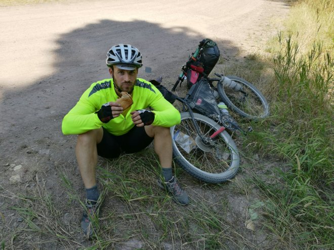
Nearly halfway up our climb we stopped at Beaver Dam Campground to refill our water, before continuing up the remainder of the climb. After crossing over an initial high point, we reached a rough dirt double track in a saddle and turned left going up steeply toward Mt. Fleecer.

Up to Mt. Fleecer.

A few hundred feet higher we turned southeast and began a frenetic, dusty single track descent, which while manageable for the first few hundred meters, quickly became too steep, rocky, and loose for comfort. Even walking our bikes downhill, we had to take regular detours into the sage brush on either side of the trail for improved traction.

Beginning the descent down Mt. Fleecer
An elevation profile you don’t usually see
Time to walk the bikes

Once completing the worst of the descent, the road quality progressively improved taking us to a junction with Montana Highway 43 at Jerry Creek.

Easier riding

A couple of miles riding west on the highway brought us to Wise River, where we camped out for a fee behind a quaint local combo bar, restaurant, motel, and RV park.

All-in-one stop

To the Single Track!

Day 10: Helena to Lowland Campground (62.6 miles, 6,903ft)

We got off to a late start leaving Helena, since we waited until 10:00 to go to have a mechanic at Great Divide Cyclery give our bikes a once over. (They have beer on tap, so an afternoon/evening visit is worthwhile.) Given the all clear, we set off from town and began a 1,500 foot climb on a well-traveled dirt road leaving the city.

This being the day of a solar eclipse—we were just north of the 100% eclipse zone in the 94% zone—halfway up the climb the sun dimmed and air became noticeably cooler, making the climb a bit more comfortable. We pulled out our eclipse glasses—which Anna (always prepared!) had provided us with—took in the eclipse, and continued on our way.

After reaching the top of our first climb we descended through a mountain valley, past a number of homes, before beginning a climb up to another pass. Quickly, we left populated areas and after a number of miles came to a beautiful highland area. After the switchback the route led above a stunning lake—Park Lake—with a national forest campsite. After a few more rolling miles along dirt road, we reached a technical, single track climb. The trail required some brief sections of hike a bike, but for the most part we were able to ride out the trail, a fun (if difficult) diversion from the wider county and forest roads we’d been riding.

Beginnings of a rougher track
A final, rocky descent from a technical track
All in order after a rough section of trail

A fun descent to the little town of Basin followed, where we stopped at a little cafe—the only open business in town—for a water refill and ice cream.  From there we followed a mix of paved, then dirt roads parallel to the interstate. After five or six miles, we moved away from the interstate, and continued up the valley we’d been following, gradually ascending to our campsite—Lowland Campground, a wonderful, secluded national forest campground. (One of the highlights of this route are the amazing campsites you can find in national forest and Bureau of Land Management areas, either established or dispersed primitive camping.)

Ascending to Lowland Campground

This wasn’t our longest day, but it was likely our hardest up until this point of the trip—and one of the prettiest.

Support cars at Lowland Campsite.

Three Pass Day!

Day 9: Lincoln to Helena (64.5 miles, 5,212ft)

After the relative ease—due to paved and dirt road detours away from forest fires—we knew that the ride from Lincoln to Helena would present a bit more of a challenge.

After having crossed to the west side of the continental divide on the second day of our trip, we hadn’t crossed again; today we had three divide crossings ahead of us. Leaving Lincoln we climbed gradually for a number of miles on wider dirt roads, before turning onto a rougher dirt track for the final few, steep and rough miles to the first of the divide crossings—thankfully, our legs were up to the test.

Dave at the top of our day’s first divide crossing after a long climb out of Lincoln

From there we descended sharply toward a valley on the other side and were startled by cows—which, to us with bears on our minds, look conspicuously similar to bears at a distance—that became more numerous as we rode through more settled pasture land.

Watch out for cows!
Descending into cattle country

Near the bottom we passed a wonderful little home and small ranch, whose owners host bikers traveling the GDMBR. The owners weren’t in when we passed, but it looked like one of those wonderful, unique places that’s particularly memorable on a long trip. Besides hosting cyclists, the home is a wonderful place for a quick break—while they weren’t home, the owners had left out a cooler with cold drinks and invitation that riders help themselves to a beverage.

GDMBR MM 88.1
We did!
A refuge for GDMBR riders between Lincoln and Helena

Shortly after the bike-friendly home, we reached a T-intersection in the valley bottom and followed another large dirt road gradually upstream, now moving slower as we biked into a headwind.

Navigating with the help of some handy, homemade signage

Again, as we rode away from homes and fields, the road became rougher and we ascended through forests to the second divide crossing of the day. The ascent was more moderate than the first pass but challenging nonetheless (and deceptive—we passed at least one false high-point). Descending on the other side along a rough road, we again rode into more open pasture country with wonderful, wide views. From here the terrain was relatively flat, with some gentle ascents and descents along reasonably well-maintained dirt roads.

Old Mine.
View from the cockpit.
Passing through more grazing land

After passing a possibly still functional cargo train stop, called Blosburg (no town or services here), we soon turned left and made a very gradual ascent to the third crossing of the day.

Glad to be at the top of the day’s final pass

All downhill from there, we continued to a paved highway that the route followed for the last 12 miles into Helena. Once in Helena we biked to the county fairgrounds on the north side of town, where (after some searching) we found the campground on the back, northwest end of the fairground complex. (Note: we heard from some other cyclists later on the trip that staying in the Helena RV park was sort of a sketchy experience.)

Fire Detour #3

Day 8: Seeley Lake to Lincoln (62 miles)

First, blueberry pancakes for breakfast.

Given that our route would take us east, directly toward the forest fires, we had to plan a detour to start our day.

The wind had changed over night, and smoke had settled in over the lake; we began our day riding through a smoky haze.

Leaving a smoky Seeley Lake

When we reached route 83 we turned south, off-route, and rode along the highway before climbing left onto a dirt road that a ranger had told us would cut the corner between highway 83 and highway 200—and with bikes set-up for dirt roads, we hoped to avoid pavement and cars as much as possible.

This road took us up into beautiful pasture land, despite having to adjust our route further upon meeting a sheriff who informed us that road closures had been expanded as the fires grew, we were able to cut out many miles of highway riding.

A dirt road detour south of the official route

Eventually, we did arrive at highway 200, but thanks to a stiff tail wind when we turned east onto the highway, we were back to the official route in Ovando in no time.

Fire closure information board.

Of course, we could only ride on the official route for a few miles before we detoured onto dirt roads south of highway 200—forest fires northwest of Lincoln had closed the official route north of the highway.

Smoke in the distance
Riding an unpaved detour.
The blue side of the sky.

We reached a paved road again, just south of Coughlin, and rode north to highway 200, which we followed, assisted by the same tail wind, the last 16 miles to Lincoln.

Highway riding into Lincoln, with forest fires burning northwest of town

After checking into camping at a local park, which happened to be packed with softball players in town for a weekend tournament, we decided on a quieter campground/RV park along a small stream.

Softball tournament at the local park
Map of fire closures
Wonder where they’re from?

Fire Detour #2

Day 7: Cedar Creek Campground to Seeley Lake (56.7 miles)

During our ride the previous day, we’d heard that large forest fires in the mountains east of Seeley Lake would likely make the second half of our coming day’s ride inaccessible. Dave and Cathy confirmed as much: a ranger in Big Fork had told them that the route was closed east of Holland Lake. (Adventure Cycling was also coordinating closely with forest and other relevant services, regularly updating a forest fire layer on an interactive map on their website—great if you have a data connection.)

Somewhat disappointed—but certainly less inconvenienced than those who’d had to evacuate their homes near Seelely Lake or the fire fighters combating the fire—David and I started off, with full loads (in case, for some reason, we wouldn’t be able to meet the support crew later in the day) planning to follow the main route as far as the Holland Lake turn-off, before continuing the rest of the way along Montana Highway 83 to Seeley Lake, where the national forest campground had just reopened.

The first 30-some miles along the official route, following forest service dirt roads on the west side of Swan River, were lovely. Rolling through forest and pasture we thoroughly enjoyed the scenery and saw our first bear of the trip—a black bear that quickly took off after hearing us approach.

Eventually, after turning east and crossing back to the east side of Swan River we reached highway 83 and turned south, heading for Seeley Lake. While we now off the official route, the road was still scenic, and we managed to get some lovely views of the Mission Mountains to our east.

Views of the Mission Mountain Range

After a quick lunch break at a turn off for Holland Lake, we made good time along the rolling paved road all the way to the national forest campground on the west side of Lake.

Lunch break
Watching the helicopters scoop water was a major highlight for all.


As well as getting ice cream in town.

The campground was great, with water, pit toilets, some bathrooms with running water, and a little beach along the lake front. Probably because of the forest fires to the East, the campground was nearly empty.

As the evening approached we got an impressive aviation show as helicopters, one after the other, flew in to scoop water out of the lake, before returning to the mountains to try to douse the fires.

Helicopter scooping water from Seeley Lake to combat forest fires

After darkness fell, we could see the fires lighting up the mountainside.

Fire on the mountain.

On the Road Again!

Day 6: Glacier NP’s Apgar to Cedar Creek Campground (83 miles)

After two days of relative rest (hiking in Glacier aside), David and I started out early from the campground, fully loaded, expecting to see Anna, the kids, and the rest of her family in 2-day’s time.

We rode 20 miles before arriving at our route (and a delicious breakfast at the Montana Coffee Traders) in Columbia Falls.

From there we continued on the route, south, riding through gentle rolling countryside in the valley, past lakes and rivers.

David and Anna help distribute signs encouraging people to Welcome Your Neighbors; apparently some of those signs have made it to Montana!
Near Echo Lake

Alternating between paved and dirt roads, the miles flew by—probably our easiest section yet of on-route riding; before we knew it we’d ridden 50 miles and had arrived in Ferndale.

A few miles south of Ferndale we continued onto a dirt forest service road and began a relatively long, but relatively mild, ascent on the west side of Swan Lake. Of course, with every ascent there’s a pay-off on the other side, and we enjoyed the next 10 miles, losing most of the elevation we’d just gained. From there, the dirt road continued roughly south, following parallel to the Swan River, going upstream. Just after passing a sign for Fatty Creek Road to the right, we turned left, off-route, and descended to Cedar Creek, where we found a wonderful little campsite along the creek, complete with picnic table and pit toilet.

Primitive campsite at Cedar Creek

As it turned out, forest fires east of Seeley Lake—the intended end point for the following day, where Anna and her family were planning to meet us—closed the lake; so Anna and her family drove down to the Cedar Creek campsite to avoid the smoke further south.

Joining us, too, later and fully-loaded, towing full sets of pannier bags and a BOB trailer—these riders worked a little harder on the uphills than we did—were Dave and Cathy, a retired couple from Napa, California.

Detour to Glacier National Park

Detour: Kalispell to Glacier National Park (33.2 miles)

All along the GDMBR, you pass world-class national parks and other natural recreation areas. Just riding through this incredible landscape is a wonderful experience, but it’s worth your time to take a few days along the way to explore what sites along the route have to offer.

For this reason, and to build in time for fun activities with our awesome support team (David’s wife and kids: Anna, Silas [2.5 years old], Eleanor [7 months old]), we planned in a 2.5-rest day detour in Glacier.

Early in the morning (campgrounds at Glacier fill quickly), David drove into the park to reserve a group campsite, where Anna’s brother, Abram, and parents, Steve and Betsy, would meet us later in the day.

When David returned to pack up the car, I headed out by bike, first to Columbia Falls and then on to Glacier National Park and Apgar Campground.

Making my way to Hungry Horse

The ride was pleasant, albeit much flatter than our previous few days of riding. To Columbia Falls, I could follow minor country and residential roads. From Columbia Falls, I followed US Highway 2 to West Glacier. With the exception of a couple miles into Hungry Horse, the highway had a wide shoulder (from Columbia Falls to a point 2 miles before Hungry Horse) or dedicated bike lane (Hungry Horse to West Glacier). From West Glacier, you can take either the road or a bike path (turn sharply right, downhill toward the river after crossing over the river on a bridge to catch the path) to the Apgar Visitor’s Center just past the entrance to the park.

At or near the park, there are grocery stores in West Glacier and Apgar Village. To explore the park, shuttle buses leave regularly from the Apgar Visitor’s Center to various trailheads throughout the park. (The visitor’s center has more information on schedules.)

Once in Glacier it was time to relax! We planned a couple of days of relatively light hiking with friends and family and enjoyed some time relaxing by Lake McDonald, not far from our campground.

Lake McDonald
Silas learning to skip (and throw) stones.
Dintaman family at Lake McDonald.

Family selfie.

Grandparents bring welcomed new toys.


Uncle Abe brings mountain goat from Utah.
Trying to keep babies, odors and bears separate.
Our aspiring bikepacker.
Highline Trail from Going to the Sun Road.
Early morning.
Hiking to Avalanche Lake.
Lunch at Avalanche Lake.
Walking the bench.
Avalanche Lake.


Fire Detour #1

Day 5: Eureka to Kalispell (60.6 miles)

Originally, we had planned a 90-some mile day from Eureka to Whitefish, heading back into the mountains and the Flathead River, but forest fires southeast of Eureka had closed portions of the route.

Instead, David and Anna contacted some friends of friends, who lived just north of Kalispell (south of the official route) and who were gracious enough to host us; so off we went for Kalispell.

For the first 12 miles from Eureka, we followed the GDMBR from town along a minor road that ran south parallel to US93. We then joined US93, and shortly ahead where the GDMBR turned east and headed for the mountains—and a fire related road closure—we continued on US93. Certainly not the most entertaining riding of the trip, but we made good time.

At one point, when US93 turned east toward Whitefish before going back south toward Kalispell, we cut the corner on KM Ranch road. Eventually, we were back on US93 for a short while—and in riding in rain for the first time on the trip—before reaching our friends’ contacts, Barb and Jerry, thankful for the hospitality of relative strangers and the prospects of warm beds and warm showers.

A Slog, but We Made It

Day 4: Butts Cabin to Eureka (73 miles)

Up Cabin Pass.

Today was easily our hardest day, to date—nearly our longest in terms of distance, with two significant climbs.

Thankfully, we were able to get off to an early start, but three days in and just getting my touring legs (and touring butt—I was starting to develop some major saddle-sore) under me, riding was slow going.

We started the day climbing to the top of Cabin Pass, where we were rewarded with some of the nicest views we’d seen all trip—majestic mountains on all sides of a narrow, flower-carpeted alpine valley.

The ascent to Cabin Pass
At Cabin Pass

A steep descent took us down a tighter valley and past a backcountry homestead on our way to Wigwam River.

Wigwam River

After a quick jaunt on a dirt road heading south, we crossed to the west side of the Wigam River, on a dirt track for non-motorized vehicle use. From here, we climbed away from the river and traveled south, ascending away from and descending to a number of mountain brooks that fed into the Wigwam River.

Loaded bikes.
Filtering water.

Shortly before arriving back at the Wigwam River, we headed right on a narrow single track that ran south, parallel to the river. The fun ended when we reached an extremely steep section of trail that ran straight up ahead of us—up we went, pushing our bikes, hoping that they didn’t push us back down over the hill.

At the start of the steep single track
Nearly there!

The hike-a-bike section was, thankfully, soon over, and we were back on a double track gravel road, which eventually intersected a road that took us up, slowly, 2500 feet to the top of Galton Pass. We bombed down the other side, descending 3000 feet in about 6 miles, before continuing, exhausted, to the USA/Canada border at Roosville and on to Eureka.

Smiley at the top of the pass.
It’s flat again!
Eureka town park.

To the Grizzly Highway

Day 3: Sparwood to Butts Cabin (57 miles)

From Sparwood, we had two route options: head east into the mountains to the Flathead River—called the “Grizzly Highway” by locals in the area (according to our guidebook)—or continue south along on a shorter and more moderate alternative route through the valley, toward Fernie.

Intrigued by the challenge of the backcountry and promise of rugged scenery, we’d opted to head for the hills. Since we’d have around 110 miles without resupply, we packed up food and gear for two days and a night out on the trail, and set off, planning to meet Anna, Silas, and Eleanor in two days in Eureka, Montana.

The first 20 miles of our route followed paved roads gradually gaining elevation all the way to Corbin. Upon reaching Corbin, we turned south on Flathead Valley Road, a decent dirt road that climbed gradually to Flathead Pass.

From the top of the pass, we began a rough decent down the other side. Significant portions of the road had been washed out, and we picked our way through gravel and large stones, which tested our technical abilities with weighted bikes. (We found ourselves walking multiple sections.)

Eventually, we arrived to the valley and Flathead River, which runs all the way down to Flathead Lake in Montana, passing on the West side of Glacier National Park along the way—unfortunately for us, we’d have to climb a couple of ridges to the West to get back to a paved road and legal border crossing. At a different time in history, we’d just follow the Flathead south.

Dave above the Flathead River.

After following along the east bank of the Flathead for several rolling miles along a dirt road, we arrived at the river, where a bridge was out. Thankfully, the water was low—about knee high (and we’d known about the missing bridge and low water in advance)—so were were able to carry our bikes across with few difficulties.

On the other side of the river, we passed a recreation area, where camping was permitted, on our left and continued a number of miles before arriving at Butts Cabin—a public cabin available on a first come-first serve basis until beds are full. We ended up having the place to ourselves.

Following a dirt road along the west side of the Flathead River toward Butt’s Cabin.
Look’in good.
Butts Cabin.
Glad we weren’t eating dehydrated meals every night.

Throughout the day, we’d been very cautious about bears, trying to make as much noise as possible, due to the warning in our guidebook that the Flathead River Valley was a major thoroughfare for grizzlies and had the highest density of grizzly bears of any location in North America. We, however, didn’t see any bear signs–no scat, no paw prints, no sightings. A bit of a let down, but certainly not a disappointment!

Not quite a bear…

Tomorrow, we’ve got a lot of climbing as we head east on our last day in Canada on our way to Montana.